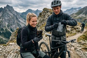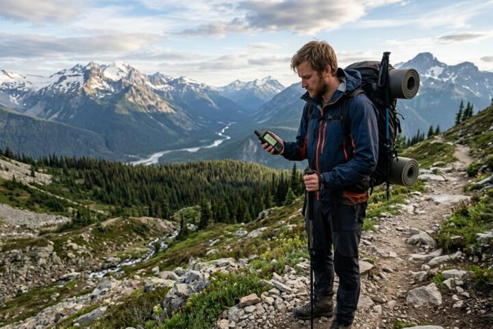
Navigating the Terrain of Remote Communication
When you step beyond the reach of the nearest cell tower—which covers only about 30% of the United States' landmass—your smartphone becomes a dedicated camera and a very expensive paperweight. In the backcountry, "GPS tracker" is a broad term that encompasses two distinct technologies: Personal Locator Beacons (PLBs) and Satellite Messengers.
Understanding the "Link Budget" is essential. This is the accounting of all gains and losses from the transmitter to the receiver. A dedicated PLB like the ACR ResQLink broadcasts at 5 Watts, while a messenger like the Garmin inReach Mini 2 operates at approximately 1.6 Watts. This power difference determines whether your SOS can punch through a heavy forest canopy in the Pacific Northwest or remains trapped under the cedar boughs.
In 2023, the National Park Service reported over 3,700 Search and Rescue incidents. A significant portion of these involve "overdue" hikers where no communication was possible. Having a device that provides an active "breadcrumb" trail allows SAR teams to narrow a search radius from 50 square miles to a 10-meter circle, saving hours of flight time for rescue helicopters.
Common Pitfalls in Solo Navigation Safety
The most frequent mistake solo hikers make is treating a satellite messenger like a smartphone. They assume that "100% global coverage" means a connection as instantaneous as 5G. In reality, satellite passes and orbital geometry mean a message might take 30 seconds or 20 minutes to send, depending on your view of the sky.
Another critical error is the "set it and forget it" mentality regarding battery management. Hikers often leave tracking intervals at 2-minute increments, draining a small device in less than two days. On a solo trek through the 211-mile John Muir Trail, a dead battery is functionally equivalent to having no device at all.
Many users also fail to realize the difference between the Iridium and Globalstar satellite networks. Using a device pinned to a non-polar orbiting network in deep canyons can result in "signal shadowing," where the device cannot see a satellite for hours. This delay in the backcountry isn't just an inconvenience; it’s a life-threatening gap in your safety protocol.
Strategic Selection Criteria for Solo Hikers
Choosing the Right Satellite Network
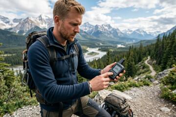
The backbone of your device is the constellation it uses. Iridium is the gold standard for solo hikers because its 66 cross-linked Low Earth Orbit (LEO) satellites provide true pole-to-pole coverage. If you are hiking in the High Sierras or the deep valleys of Glacier National Park, an Iridium-based device like the Garmin inReach or Zoleo is non-negotiable.
Power Output vs. Two-Way Messaging
If your priority is a "guaranteed" SOS, a PLB is the superior choice. These devices connect directly to the Cospas-Sarsat international satellite system, which is government-funded and requires no subscription. However, for solo hikers, the ability to communicate non-emergencies is a massive psychological and logistical boost. Using a Bivy Stick or Motorola Defy Satellite Link allows you to tell family, "I'm fine, just camping 5 miles short of the goal," preventing them from calling SAR unnecessarily.
Battery Longevity and Weight Ratios
For an ultralight solo hiker, every gram counts, but battery life is the ultimate currency. The Garmin inReach Messenger stands out here, offering up to 28 days of battery life in 10-minute tracking mode. Compare this to the Apple iPhone 14/15/16 Satellite SOS feature, which is a fantastic backup but drains the phone's primary battery rapidly and lacks dedicated ruggedness.
Logistics of Subscription Management
Satellite messengers require monthly plans, often ranging from $15 to $65. If you only hike three months a year, look for "Freedom" plans (like those from Garmin) or "Suspend" options (like Zoleo). Be aware of "activation fees," which can hide the true cost of a "cheap" device. Over a three-year lifespan, a PLB with no subscription is often $400 cheaper than a messenger.
Integration with Offline Mapping
A tracker shouldn't just send signals; it should help you stay on the trail. Devices that pair via Bluetooth to apps like Gaia GPS or onX Backcountry allow you to see your satellite-synced position on high-resolution topographic maps. This synergy reduces the "looking at the screen" time and keeps your eyes on the trail.
Physical Durability and IP Ratings
Your device will be dropped on granite, soaked in rain, and baked in 100°F heat. Look for an IPX7 rating at minimum, meaning the device can withstand immersion in 1 meter of water for 30 minutes. The Somewear Global Hotspot is built to military standards, ensuring that when the "worst-case scenario" happens, the hardware still functions.
Real-World Reliability Scenarios
Case Study: The Wind River Range Incident
A solo hiker in Wyoming's Wind River Range suffered a tibia fracture at 10,500 feet. The hiker was using a Garmin inReach Mini.
- Problem: Heavy cloud cover and steep granite walls.
- Action: The hiker triggered the SOS and used the two-way messaging to specify the nature of the injury (non-life-threatening but non-ambulatory).
- Result: SAR dispatched a ground team instead of an expensive (and high-risk) night-time helicopter extraction. The communication allowed the hiker to stay calm, knowing help was 6 hours away. Total cost of rescue was reduced by an estimated $12,000 due to accurate info.
Case Study: The Adirondack "False Alarm"
A solo trekker failed to return by 6 PM. Family members, panicked, were about to call the State Police.
- Problem: The hiker was safe but delayed by a swollen stream crossing.
- Action: Using a Zoleo messenger, the hiker sent a "Check-in" message with GPS coordinates at 5:45 PM.
- Result: The message reached the family via the Zoleo app (which switches between Satellite, Wi-Fi, and Cellular). No SAR resources were wasted.
Critical Comparison: PLBs vs. Satellite Messengers
| Feature | Personal Locator Beacon (PLB) | Satellite Messenger |
|---|---|---|
| Primary Use | Emergency SOS Only | SOS + Daily Communication |
| Subscription | None (Free after purchase) | Monthly/Annual Fees ($15+) |
| Transmission Power | 5.0 Watts | ~1.6 Watts |
| Battery Life | 5+ Years (Non-rechargeable) | 2–30 Days (Rechargeable) |
| Signal Confirmation | Some (Return Link Service) | Yes (Two-way Texting) |
| GPS Tracking | No | Yes (Breadcrumb Trails) |
| Best For | Extreme Remote/Maritime | Standard Backcountry/Social |
Avoiding Frequent Navigation Errors
Do not clip your device to the outside of your pack with a flimsy carabiner. The "brush-off" is a real phenomenon where a thicket of rhododendron or alder strips the device from your pack without you noticing. Always use a tether.
Never rely on the "Auto-Track" feature without testing it first. Different devices have "dead zones" near the body. If you wear the tracker on your shoulder strap, ensure the antenna has a clear view of the sky. Placing it inside the "brain" of your pack can reduce signal strength by up to 50% due to fabric and stored gear.
Don't ignore the "Return Link Service" (RLS). When buying a PLB, ensure it has RLS (like the ACR ResQLink View). This feature provides a blue light confirmation that the satellite has actually received your distress signal, which is a massive psychological relief during a solo crisis.
FAQ
Does a GPS tracker work in deep canyons?
It depends on the network. Iridium-based devices perform better because they have more satellites in the sky at once, but even then, you may need to move to a clearing or higher ground to get a message through.
Can I use my phone's Satellite SOS instead of a dedicated device?
It is a great backup, but not a replacement. Phones are not ruggedized for long-term exposure, their batteries die quickly in the cold, and they lack the dedicated high-gain antennas found on devices like a Garmin or ACR.
What happens when I press the SOS button?
The signal goes to a 24/7 monitoring center (like IERCC). They verify the signal, gather your GPS data, and contact the local SAR agency responsible for that specific geographic area.
Is the subscription worth it for one trip a year?
If you hike solo, yes. Think of it as "rescue insurance." Many plans also include specialized SAR insurance that covers the cost of private life-flight helicopters, which can exceed $50,000.
Do these devices work under tree canopy?
High-powered PLBs (5W) usually penetrate heavy canopy well. Lower-powered messengers (1.6W) may struggle or require multiple attempts to "handshake" with a satellite.
Author’s Insight
In my fifteen years of solo trekking through the Brooks Range and the Smokies, I’ve moved from carrying nothing to carrying a dedicated two-way messenger. The biggest lesson I’ve learned isn’t about the SOS button—it’s about the "Check-In" button. Being able to tell my partner exactly where I am at 8 PM every night prevents a "passive SAR" situation where people start worrying just because I'm out of cell range. My advice: buy the device that uses the Iridium network, and always carry a backup power bank specifically for it.
Conclusion
Selecting the right backcountry communicator is a balance between the raw power of a PLB and the versatile communication of a satellite messenger. For solo hikers, the ability to provide two-way context to rescuers and routine updates to family makes a messenger the superior daily tool, provided you manage the battery and subscription costs. Before your next solo outing, verify your device's firmware, test a message in an open field, and ensure your emergency contacts know exactly how to interpret the data your device sends. High-quality satellite tech doesn't just save your life; it provides the peace of mind necessary to actually enjoy the solitude you seek.